
📸 How it went



What is included
Route program
Group meeting and preparation
Participants meet, get to know each other, and check their gear. A route and safety briefing is provided. The hiking section begins at 8:30 AM.
Sunkar Family Recreation CentreAscent via Kazachka
Walking from the environmental checkpoint towards Kazachka, then climb along a forest trail. This is the most physically demanding part of the route. The group takes short rest breaks on steep sections.
Sunkar - Kazachka - start of the Japanese RoadHike along the Japanese Road
Reaching an elevation of approximately 1,900 metres and continue along the old service road. The route offers views of Big Almaty Gorge and the surrounding peaks. A 20-30 minute break is planned for rest, photos, and a snack.
Highest point - Japanese RoadDescent to the Ayusai Visitor Centre
A gradual descent along the old road and winding route. The trail reaches the main paved road, where the group continues towards the Ayusai Visitor Centre. A short break is planned near the centre.
Japanese Road - winding road - Ayusai Visitor CentreDescent to the GES-2 bus stop
Descending to the bus stop at a relaxed pace, where the route ends.
Ayusai Visitor Centre - GES-2Description
The Japanese Road in Almaty is suitable for a long day hike without climbing a high summit. The route crosses forested and exposed slopes in Big Almaty Gorge, with views of the Bolshaya Almatinka River valley, surrounding ridges and mountain peaks.
The route’s main feature is its variety. It begins with a noticeable ascent through Kazachka, followed by a long traverse along an old road with minor elevation changes. The final section descends to the Ayusai Visitor Centre and a public transport stop.
This is a linear route with different starting and finishing points, so there is no need to walk back to the Sunkar centre.
Key route details
Start: Sunkar Family Recreation Centre, near the environmental checkpoint
Finish: Olen bus stop near GES-2
Route: Sunkar - Kazachka - Japanese Road - winding road - Ayusai Visitor Centre - GES-2 - Olen bus stop
Distance: approximately 14-15 km
Duration: 6-7 hours, including breaks
Elevation gain: approximately 590-650 m
Highest point: approximately 1,900-1,940 m
Route type: linear
Difficulty: moderate
Recommended direction: ascend via Kazachka and descend towards Ayusai
GPS readings may vary. Visiting Ayusai Waterfall, exploring side trails or making additional detours near the visitor centre may increase the total distance to 16 km.
Starting near the Sunkar centre
The route begins near the Sunkar Family Recreation Centre and environmental checkpoint in Big Almaty Gorge. After checking their gear, the group heads towards Kazachka Gorge.
The first kilometres include paved and unpaved sections. The Kazachka complex serves as a landmark. Beyond it, a trail begins climbing through the forested slope.
The route passes through a national park, where an environmental fee may apply. Check the current access rules and fee before the hike.
Ascent through Kazachka
The ascent from Kazachka is the most physically demanding part of the hike. The trail passes through mixed forest and gradually gains elevation. Some sections contain sharp turns, rocks, tree roots and loose ground.
The ground becomes slippery after rain, while snow and ice may remain on shaded sections during winter. Trekking poles make both the ascent and later descent easier.
Working areas and shepherd dogs may be encountered around Kazachka. Stay on the main trail, do not approach the animals and cross this section as a compact group.
The forest gradually becomes less dense, revealing views of Big Almaty Gorge between the trees. Reaching the upper part of the route usually takes between 1.5 and 2 hours.
Reaching the Japanese Road
After the main ascent, the trail reaches a wide old road traversing the mountainside. The steep climb ends here, and the more gradual part of the hike begins.
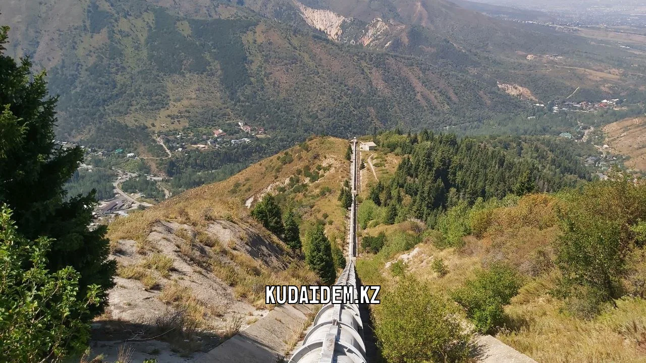
Most of the Japanese Road is almost level or includes only minor changes in elevation. The route passes exposed slopes, forest sections, stone retaining walls and traces of old technical infrastructure.
Remains of structures and sealed tunnels can be seen in some places. Do not enter them. Old workings may be flooded, partially collapsed or blocked by fallen rocks.
Why is it called the Japanese Road?
According to a common local story, Japanese prisoners of war built the road after the end of the Second World War. Japanese prisoners of war are known to have worked in Almaty and taken part in the construction of various facilities.
However, there is insufficient direct documentary evidence that they built the entire mountain road. It is therefore more accurate to describe this as a local explanation of the name rather than an established fact.
The road’s practical purpose was connected with maintaining hydraulic infrastructure and the cascade of small hydroelectric power stations in Big Almaty Gorge. It is no longer used as a vehicle road and now mainly serves as a hiking trail.
What can you see along the way?
The exposed sections offer views of the Bolshaya Almatinka River, forested slopes, the road towards Big Almaty Lake and the ridges of the Trans-Ili Alatau. In clear weather, hikers may see Big Almaty Peak, Molodezhny Peak and Kanysh Satpayev Peak, which many hikers know by its former name, Sovetov Peak.
In spring, the slopes are covered with young greenery and flowers. Exposed sections become very hot in summer. In autumn, yellow deciduous trees contrast with dark Tian Shan spruce.
The Japanese Road crosses exposed, south-facing slopes. There is less shade than the map may suggest, so a hat, sunglasses and enough water are essential in summer.
Rest stop on the upper route
The wider sections of the road provide suitable places for a longer break. Choose stable ground away from the main trail and scree slopes.
There are no guaranteed developed sources of drinking water along the route. Streams may dry up or be contaminated farther upstream. Carry at least 1.5 litres of water per person and more in hot weather.
After the break, the route continues along the old road towards Big Almaty Gorge. The trail remains fairly wide, but extra care is required on damaged sections and near steep drops.
Descending the winding road to Ayusai
A winding descent begins at the end of the Japanese Road. It gradually loses elevation and reaches the main paved road leading to Big Almaty Lake.
Continue downhill after reaching the paved road. The route arrives at the Ayusai Visitor Centre after approximately 15-20 minutes. It can be recognised by its tourist facilities and bear sculpture installation.
Visitors may be able to rest, use the toilets and purchase drinks or food if the relevant facilities are open. Do not rely on fixed opening hours, particularly early in the morning, on weekdays or outside the main season.
If time allows, the route can be extended with a visit to the Lower Ayusai Waterfall. This out-and-back detour increases the distance and duration of the hike.
Descent from Ayusai to Olen bus stop
The final section begins after the visitor centre. Follow the road downhill towards GES-2 and Olen bus stop. This section is mostly paved and takes approximately one hour.
Despite the easy terrain, the descent may feel tiring after the distance already covered. Stay on the safe side of the road and remain aware of passing vehicles.
The route finishes near GES-2 and the well-known deer sculpture landmark. A nearby bus stop provides transport back to the city.
Distance breakdown
Without lengthy detours, the approximate distances are:
Sunkar centre to the Kazachka area: approximately 2 km
Ascent through Kazachka to the Japanese Road: approximately 3 km
Japanese Road and winding descent: approximately 5-6 km
Ayusai Visitor Centre to Olen bus stop: approximately 4 km
The total distance is approximately 14-15 km.
Finishing near the visitor centre shortens the route. Visiting Ayusai Waterfall or side viewpoints increases the distance.
Route difficulty
The Japanese Road does not require mountaineering experience, but the full route should not be treated as an easy walk. Participants cover up to 15 km and gain approximately 600 metres of elevation.
The main challenges include:
The steep initial ascent through Kazachka
The long distance
Exposed sunny sections
Loose ground during dry weather
Mud and slippery roots after rain
Snow and ice in winter
The long descent over winding and paved roads
In dry, stable weather, the route may be suitable for active beginners with reasonable fitness and school-age children accompanied by adults. It is not suitable for young children, pushchairs or people with significant mobility limitations.
What to bring
Recommended equipment includes:
Hiking shoes or boots with non-slip soles
Trekking poles
At least 1.5 litres of water per person
Snacks and a light lunch
A windproof jacket or raincoat
A hat
Sunglasses and sunscreen
A small first-aid kit
A fully charged phone and power bank
A bag for personal rubbish
Traction cleats may be required in winter and early spring. Postpone the route after heavy snowfall or rain if the steep slopes are unsafe.
Important route rules
Do not start the route at the pipeline near GES-2. Access to some technical sections is restricted, while fences and closed areas belong to active infrastructure. The ascent through Kazachka better matches the route described here.
Do not enter sealed tunnels, cross fences, light fires outside designated areas or leave rubbish. The route passes through Ile-Alatau State National Nature Park, where environmental regulations must be followed.
Who is this hike suitable for?
The Japanese Road in Almaty is suitable for those who want a varied route without climbing a high summit. It combines a noticeable ascent, a long traverse along an old road, panoramic views and a convenient exit near the visitor centre.
The route is particularly enjoyable in spring and autumn when the exposed slopes are not excessively hot. Its linear format means participants do not need to retrace the same trail. The hike begins near Sunkar and finishes at Olen bus stop in the GES-2 area.
Поход прошел отлично, большое спасибо Айдыну! Живописная дорога, не очень стремительный подъем и передышки сделали последний летний поход очень запоминающимся!
Alexandra


