
📸 How it went


Route program
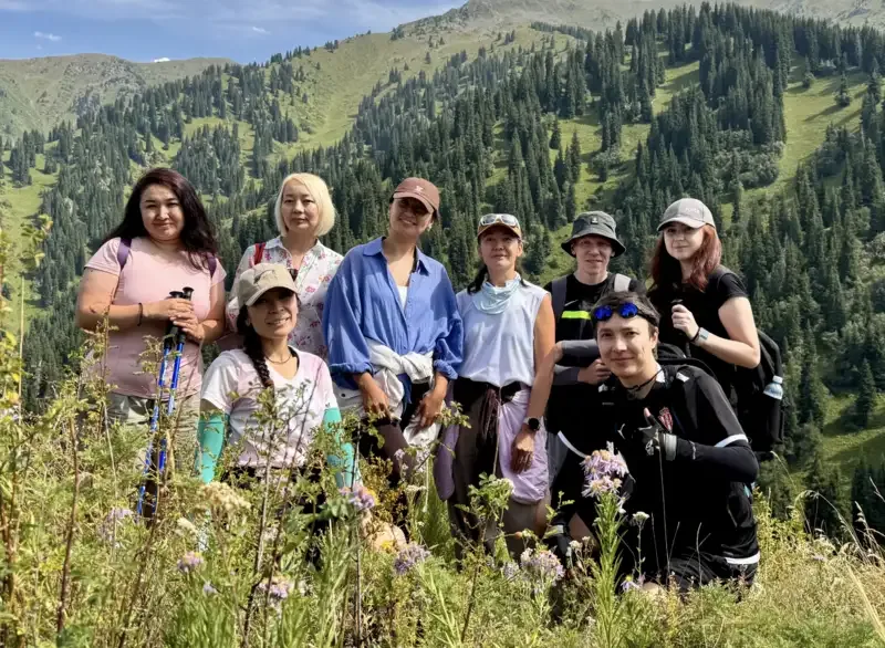
Group meeting
Meet, check our gear, and review the route.
Fountain near MedeuВыход в ущелье Кимасар
Begin the hike at the Medeu bus stop. We follow the road into Kimasar Gorge, gradually gaining elevation. Before joining the main mountain trail, we take a short break.
Medeu bus stop - Kimasar GorgeAscent to Mount Tynyshtau
Following the forest trail to the first summit of the route. At Tynyshtau, we take a break, take photos, and enjoy panoramic views of Kimasar Gorge.
Kimasar Gorge - TynyshtauHike to Mount Yelovaya
Продолжаем движение по лесистому хребту. Перед Еловой тропа становится круче. На вершине устраиваем основной привал с перекусом и готовимся к спуску.
Tynyshtau - Mount YelovayaDescent from Mount Yelovaya
Descending along the route through the coniferous forest. At trail junctions, we avoid turning towards Butakovka Gorge. On steep and slippery sections, we maintain a safe distance between participants.
Mount Yelovaya - Kimasar GorgeDescription
Mount Yelovaya is located in the Trans-Ili Alatau on the forested ridge between Kimasar and Butakovka gorges. It can be reached from Medeu along a developed mountain route via Tynyshtau. This option is interesting because it turns away from the popular trail to the Kimasar Swings and Furmanov Peak.
The hike passes through mixed forest, open clearings, saddles and several viewpoints. No technical climbing is required in dry, snow-free conditions, but the long ascent, steep forest slopes and trail junctions require reasonable physical fitness and careful navigation.
The full route from the Medeu bus stop and back is approximately 12 km. Total elevation gain is around 900-1,000 m. Tynyshtau sits at approximately 2,200 m, while the highest point, Mount Yelovaya, reaches approximately 2,330 m. Allow at least 4-5 hours, including rest stops.
The route in one sentence
Medeu bus stop - Kimasar Gorge - start of the mountain trail - Mount Tynyshtau - saddle - Mount Yelovaya - descent along the marked route - Kimasar Gorge - Medeu.
How to reach the starting point
The hike begins at the final Medeu bus stop. From the stop, follow the road into Kimasar Gorge. The first section follows a paved road past houses and recreation areas. The main mountain trail begins where the road ends.
On maps, the trail is marked as Mountain Hiking Route 175: “Kimasar - Mount Tynyshtau - Mount Yelovaya - Kimasar.” Side trails in the forest may lead towards Butakovka, Serkebay, the swings or the Furmanov ridge.
To reach Mount Yelovaya, do not follow the most popular trail to the swings. At junctions, follow the signs for Tynyshtau and Yelovaya.
Ascent through Kimasar Gorge
The lower part of Kimasar passes through deciduous trees, shrubs and sections of Tian Shan spruce forest. The trail gradually gains elevation and crosses several open clearings.
The gorge is particularly beautiful in spring and early summer when the slopes are covered with grass and flowers. In autumn, yellow leaves contrast with the dark coniferous forest. After rain, the ground, tree roots and grassy slopes become slippery.
As the trail climbs, it reaches the ridge. From here, there are views of Kimasar, Medeu and the northern spurs of the Trans-Ili Alatau. The sounds of the city gradually disappear, making this route noticeably quieter than the popular trails towards the swings.
Mount Tynyshtau
Tynyshtau is the first main point of the route. On modern maps, it is marked as a mountain and viewpoint near the Kimasar saddle. The name can be translated as “quiet mountain.” The Kazakh word “tynysh” is associated with quiet, calm and an absence of bustle.
The summit does not have a distinct rocky peak. It is a forested elevation with several open sections overlooking Kimasar Gorge, neighbouring ridges and the direction of the onward route.
Tynyshtau is a convenient place for a short break. The main ascent is not yet over, so it is better to save a longer stop for Yelovaya or the wind-protected saddle.
From Tynyshtau to Yelovaya
After Tynyshtau, the route continues along the ridge towards Mount Yelovaya. This section passes through coniferous forest and small clearings. Views of Butakovka Gorge appear between the trees.
The slope becomes steeper before the summit. Older hiking reports warn that direct trails to Yelovaya may disappear or lead to difficult terrain. It is safer to remain on the marked route instead of taking shortcuts directly across the forested slope.
In rainy weather, wet grass, roots and loose soil make the ascent more difficult. Traction aids or footwear crampons may be required in winter.
Mount Yelovaya
Mount Yelovaya takes its name from the dense coniferous forest. Its slopes are covered with Tian Shan spruce, also known as Schrenk’s spruce. Unlike the exposed peaks of the Trans-Ili Alatau, Yelovaya feels more like a quiet forested hill.
From the summit and nearby clearings, hikers can see Kimasar and Butakovka gorges, the surrounding spurs and part of the city panorama. Visibility depends on the season. Trees partially block the view in summer, while the space between the branches becomes more open in late autumn and winter.
Mount Yelovaya is suitable for those who appreciate forest routes, quiet surroundings and moderate elevations. However, the final ascent should not be underestimated. It may be tiring for someone without hiking experience.
How to descend to Medeu
To return to Medeu, continue along Route 175 and complete the loop through Kimasar Gorge. At junctions, take care not to descend towards Butakovka Gorge. That option is also possible, but it ends far from the original starting point.
After reaching the main road, the route descends through the gorge to the Medeu bus stop. Trekking poles are useful on the descent because forest sections may be slippery, while the long downhill section places additional strain on the knees.
Route difficulty
The route is moderately difficult. Mountaineering equipment is not required in dry, snow-free conditions, but the trail includes a long ascent, forest junctions and several steep sections.
The main challenges are:
elevation gain beginning almost immediately;
slippery roots and ground after precipitation;
poorly defined side trails;
the steep approach to Yelovaya;
limited visibility and difficult navigation in fog;
snow and ice on shaded slopes in winter.
For a first hike, it may be better to choose a shorter route through Kimasar. The Tynyshtau and Yelovaya combination may be suitable for active beginners with good endurance or hikers with some mountain experience.
Best time to hike
The route can be completed year-round, but conditions differ significantly between seasons.
Spring may bring mud, wet snow and high water levels in streams. In summer, consider the heat on exposed sections and the possibility of afternoon thunderstorms. Fallen leaves may cover the trail in autumn. Ice and deep snow form on northern slopes in winter.
Before setting out, check the weather forecast, trail conditions and any warnings issued by rescue services or the national park.
What to bring
Recommended equipment includes hiking shoes or boots with good tread, trekking poles, a windproof jacket or raincoat, a warm layer, water, snacks, a first-aid kit, a fully charged phone and a power bank.
Mobile coverage may be unreliable in the forest, and some trails look similar. In winter, also bring warm clothing, gloves and suitable traction equipment.
Interesting facts and history
Kimasar Gorge is also known as Kim-Asar and Komissarovskoye Gorge. The Komissarovka River flows through it and belongs to the Malaya Almatinka River basin.
The gorge contains an archaeological site dating from the Early Iron Age. It is located on a terrace above the stream and is included in Almaty’s list of historical and cultural monuments of local significance. This indicates that people used the area long before modern hiking trails appeared.
In 2025, the route through Tynyshtau and Yelovaya was included among Almaty’s mountain trails undergoing improvements. Navigation markers, information boards and rest areas were installed along the trail.
Schrenk’s spruce, which grows on the slopes of Yelovaya, is characteristic of the Northern Tian Shan. It was named after Alexander Schrenk, a traveller and naturalist who studied the region’s vegetation in the 19th century.
Tynyshtau is a relatively recent name on popular digital maps. In older reports, the location may have been described as a viewpoint, saddle or part of the Kimasar ridge.
Summary
Mount Yelovaya and Tynyshtau form a quiet forest route near Medeu. It is suitable for hikers who want to leave the crowded trails, pass through Kimasar Gorge and explore a lesser-known part of the Almaty mountains.
The route’s main advantages are a convenient starting point, coniferous forest, two summits, panoramic views of Kimasar and the option to return to Medeu without arranging additional transport.


