
📸 How it went

What is included
Route program
Group meeting at the eco-checkpoint
Participants meet, get acquainted, and check their gear. A short briefing on the route and safety rules follows. The hike begins at 07:50.
Alma-Arasan eco-checkpoint, near the Sunkar recreation centreAscent along the Japanese Road
Heading from the eco-checkpoint towards Kokshoky, formerly known as Kazachka. The route then climbs through apple orchards and along the switchbacks of the old Japanese Road. A short break is planned near the upper section of the pipeline.
eco-checkpoint - Kokshoky (Kazachka) - apple orchards - Japanese RoadAscent to Smotrovaya Mountain
Following the Japanese Road to a technical building and then reach the Terisbutak Ridge. The trail passes through the forest before climbing along an open ridge to Smotrovaya Mountain at approximately 2,350 metres. Time is planned at the summit for rest, snacks, and photos.
Japanese Road - Terisbutak Ridge - Kokshoky - Smotrovaya MountainDescent via Gvardeysky Pass
Descending from the summit towards Gvardeysky Pass, then continue along the forest edge and an open meadow. The trail may be difficult to follow on the first sections. Farther down, the route joins the Kok-Zhailau - Kokshoky dirt road.
Smotrovaya Mountain - Gvardeysky Pass - Terisbutak GorgeReturn to the eco-checkpoint
Descending through the Terisbutak Gorge, passing forest sections and open glades. The route then continues through Kokshoky and follows the paved road back to the Sunkar recreation centre. The hike finishes near the eco-checkpoint at around 15:00.
Kok-Zhailau - Kokshoky road - Alma-Arasan eco-checkpointDescription
Smotrovaya Mountain is located on the Terisbutak Ridge between the Big Almaty Gorge and the Kok-Zhailau area. The summit is approximately 2,350 metres high. Its open dome offers views of Almaty, Big Almaty Peak, the Big Almaty Gorge, and the mountain ridges towards Kok-Zhailau.
The route is best completed as a loop. The ascent follows the Japanese Road, while the descent passes through Gvardeysky Pass and the Terisbutak Gorge towards the former settlement of Kazachka. This direction allows hikers to explore different parts of the area without returning along the same trail.
Route details
Start and finish: Alma-Arasan eco-checkpoint near the Sunkar recreation centre
Route: eco-checkpoint - Kazachka - Japanese Road - Terisbutak Ridge - Smotrovaya Mountain - Gvardeysky Pass - Kok-Zhailau - Kokshoky road - eco-checkpoint
Distance: approximately 16-18 km
Practical estimate: approximately 15 km
Summit elevation: approximately 2,350 metres
Elevation gain: approximately 1,050-1,200 metres
Duration: 7-9 hours with breaks
Route type: loop
Difficulty: moderate to moderately difficult
Season: accessible year-round, depending on trail conditions
GPS readings may vary due to different starting points, additional visits to panoramic viewpoints, and descent options. Some shorter tracks begin above the eco-checkpoint, so hikers completing the full route from Sunkar should plan for at least 18 km.
Kazachka, Kokshoky, and Terisbutak: the correct names
The settlement that many Almaty residents still call Kazachka is now known as Kokshoky. The name Terisbutak is also used in descriptions of local mountain routes. It refers to the gorge, river, and ridge crossed on the way to Smotrovaya Mountain.
Both versions can be used for easier navigation:
Kazachka: the old and familiar local name
Kokshoky: the modern name of the settlement and one of the elevated points on the route
Terisbutak: the name of the gorge, river, and ridge
These names may appear together on maps and in navigation apps.
Starting from the Alma-Arasan eco-checkpoint
The hike begins near the Ile-Alatau National Park eco-checkpoint and the Sunkar family recreation centre. After passing the checkpoint, turn left and follow the paved road towards Kokshoky and the Terisbutak Gorge.
After approximately 400 metres, there is a turn towards hotel and private properties. The route then passes old orchards, where a dirt trail begins to climb steeply up the slope.
Horses, domestic animals, and guard dogs may be encountered on the lower section. Do not approach farm buildings, feed the animals, or leave the main trail.
Ascent through the apple orchards
The first significant climb passes through apple orchards. The trail is steep in places, but the direction is fairly clear: continue uphill until reaching the switchbacks of the old road.
In spring, this section is known for flowering trees and fresh greenery. In autumn, hikers can see ripening apples and colourful foliage. Fruit must not be picked on private property.
After rain, the ground becomes muddy and slippery. The sections used by horses can be particularly wet. Trekking poles help with balance and reduce strain on the knees.
The old Japanese Road
The trail from the orchards joins an old service road. A long ascent then follows a series of switchbacks. The road changes direction several times and gradually leads towards the water pipeline and hydroelectric power facilities.
The name “Japanese Road” is linked to a common local story that Japanese prisoners of war helped build the hydrotechnical infrastructure after the Second World War. Japanese prisoners of war did work in Almaty, but there is insufficient documentary evidence to determine which sections of the road they built.
The road originally served a technical purpose. It provided access to tunnels, pipelines, and facilities belonging to the chain of hydroelectric power stations. Today, most of the old road is used as a hiking route.
Do not enter technical buildings, tunnels, or surge shafts. These are active or closed industrial facilities that are not intended for tourists.
From the Japanese Road to the ridge
After reaching the upper section of the pipeline, the route continues along the Japanese Road for a while. After approximately 800 metres, there is a junction where hikers need to turn uphill.
The wide road makes several turns and ends near a small technical building. A forest trail to the Terisbutak Ridge begins here.
The trail initially climbs through the forest at a moderate gradient. The trees then give way to an open ridge. Careful navigation is especially important here, as side trails may lead back to the Japanese Road or towards neighbouring slopes.
Kokshoky Mountain and the approach to Smotrovaya
The ridge route leads to the Kokshoky elevation. There may be no distinct summit or official marker here. The trail then descends slightly towards a small saddle.
It is possible to begin the descent towards the Terisbutak Gorge from the saddle. To reach Smotrovaya Mountain, continue straight along the ridge. After the next climb, the trail reaches the summit’s open dome.
The south-facing slope affects trail conditions. There is usually less snow here in winter than in shaded gorges, but hard ice is common. In summer, the exposed slope becomes very hot, with almost no shelter from the sun.
Summit of Smotrovaya Mountain
Smotrovaya Mountain is approximately 2,350 metres high. Some GPS devices show readings between 2,350 and 2,380 metres. The difference is caused by GPS accuracy and the choice of a specific panoramic point.
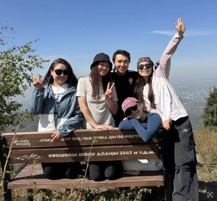
There is a sign at the summit. The main landmark is the open, treeless dome with panoramic views in several directions. It offers excellent views of the city and the Kok-Zhailau Gorge.
In clear weather, hikers can see:
Big Almaty Peak
Big Almaty Gorge
Kargalinsky and Kamensky peaks
the ridge towards Yunyi Geolog
the Kok-Zhailau area
Almaty and the surrounding foothills
Large birds are often seen near the summit, using rising air currents above the sun-warmed slopes.
Descent through Gvardeysky Pass
After resting, return from the summit to the main junction and descend towards Gvardeysky Pass. The first 500-600 metres of the trail may be difficult to follow, especially in tall summer grass or after winter snowfall.
The descent passes along the boundary between the forest and an open meadow. Farther down, a well-used trail appears and leads to the road in the Terisbutak Gorge.
Kok-Zhailau - Kokshoky road
After reaching the dirt road, the route continues downhill through the gorge. This road connects the Kok-Zhailau area with Kokshoky, formerly known as Kazachka.
The descent passes a stream, forest sections, and open glades. The dirt road gradually becomes wider and leads towards hotel complexes, private houses, and the paved road.
Continue downhill to the Alma-Arasan eco-checkpoint, where the loop route ends.
Clarification about mountain route No. 101
Mountain route No. 101 describes the classic crossing from the Ak-Bulak bus stop near Medeu through Kok-Zhailau to the Big Almaty Gorge. Its total length is approximately 14.6 km.
The hike to Smotrovaya Mountain from the Alma-Arasan eco-checkpoint does not follow route No. 101 in full. The descent uses the western part of the trail network connecting Kok-Zhailau, Terisbutak, and Kokshoky. It is therefore more accurate to consider this hike a separate loop route that partially overlaps with route No. 101.
Distance from the eco-checkpoint
Approximate distance breakdown:
From the eco-checkpoint to the start of the ascent through the orchards: approximately 1 km
Ascent along the Japanese Road to the pipeline: approximately 3 km
Crossing the Terisbutak Ridge to Smotrovaya: approximately 3.5-4 km
Descent through Gvardeysky Pass: approximately 2-3 km
Return along the road through Kokshoky: approximately 4 km
The total distance is approximately 16-18 km.
A shorter option returning along the Japanese Road may be approximately 12-14 km. Additional visits to panoramic viewpoints can increase the route to 20 km.
Hike difficulty
The route does not require mountaineering equipment, but the sustained elevation gain makes it physically more demanding than a regular walk along the Japanese Road.
Main challenges:
Steep ascent through the apple orchards
Long switchback sections
Total elevation gain of more than 1,000 metres
Heat on the exposed ridge
Mud after rain
Poorly visible trail near Gvardeysky Pass
Ice and snow during the colder months
Long descent along the dirt road
The route is suitable for active hikers with moderate or good physical fitness. Beginners are advised to go with someone familiar with the local junctions.
Best time to hike
Spring and autumn are the most comfortable seasons. Apple orchards bloom in spring, while temperatures on exposed slopes remain moderate. In autumn, there are fewer insects, visibility improves, and the forest changes colour.
In summer, start early in the morning. The southern slopes heat up quickly, and most of the ridge offers no protection from the sun. Winter conditions require traction devices, warm clothing, and experience navigating snow-covered terrain.
It is best to postpone the hike after heavy rain. Clay sections on the ridge and the road through Terisbutak become extremely slippery.
What to bring
For this route, you will need:
Hiking boots or trail shoes with good grip
Trekking poles
At least 1.5-2 litres of water
Lunch and snacks
A windbreaker or rain jacket
A hat or cap
Sunglasses and sunscreen
A small first-aid kit
A fully charged phone
A power bank
An offline map or GPS track
Traction devices during the colder months
A bag for your rubbish
There are no reliable water sources on the upper part of the route. Streams may dry up or be contaminated upstream.
Who this route is suitable for
Smotrovaya Mountain in Almaty is suitable for hikers who want a full mountain route without climbing a 3,000-metre peak. The hike includes forest, apple orchards, an old service road, an open ridge, and a long descent through a different gorge.
The loop format makes the hike more varied than an ascent and descent along the same trail. In good weather, the route offers views of the Big Almaty Gorge, Kok-Zhailau, and the Almaty skyline.
супер вайбовый поход через японскую дорогу. Посмотрели три точки: гора смотровая, перевал гвардейский, пятипалая ель😍
спасибо 🫶🏻


