
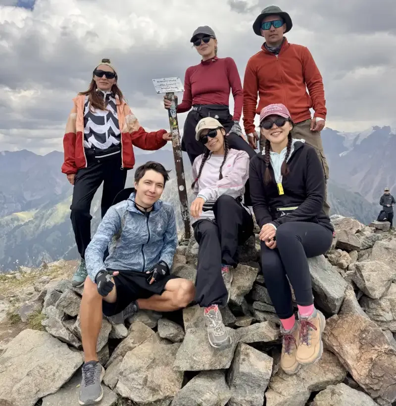
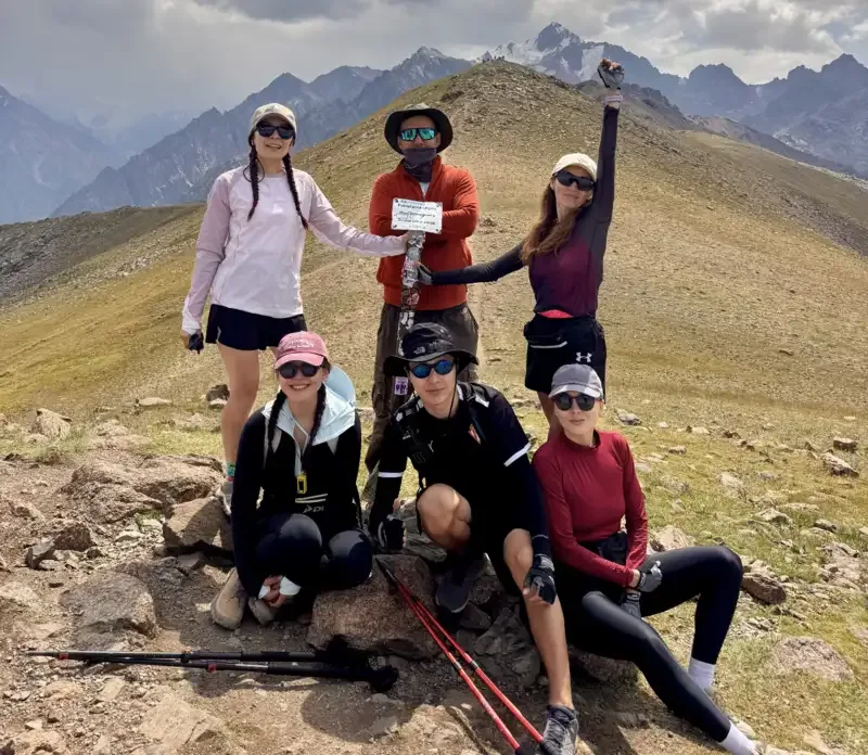
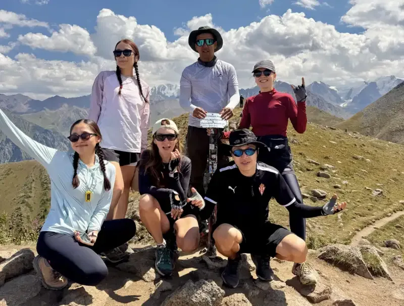
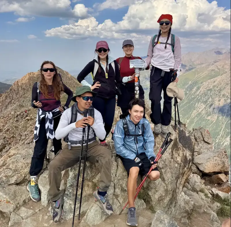
📸 How it went
What is included
Route program
Group meeting and preparation
Meet by the fountain at Medeu and check footwear, clothing, water, and food supplies. We discuss turnaround times, the group’s movement order, and the conditions that require us to turn back.
Final Medeu bus stop, by the fountainKimasar Swings and Enthusiasts’ Glade
Ascending through Kimasar Gorge, pass the forested section of the route, and reach the open ridge. After a short stop near the swings, we continue climbing to Enthusiasts’ Glade.
Kimasar Gorge - Kimasar Swings - Enthusiasts’ GladeFurmanovka, Panorama, and Bashuta
Climbing the rocky trail to Furmanov Peak, then follow the high, exposed ridge via Panorama towards Bashuta. At Panorama, we take a short break for a snack and to check the group’s condition.
Furmanov Peak, 3,053 m - Panorama Peak, 3,260 m - Bashuta Peak, 3,355 mChimbulachka and Big Talgar Pass
After Bashuta, we descend to the saddle and begin the steep scree ascent to Chimbulachka. From the summit, we descend to Big Talgar Pass and the upper cable car station.
Chimbulachka Peak, approximately 3,460 m - Big Talgar PassShymbulak and walking descent to Medeu
Taking the cable car down to the Shymbulak base station, then walk approximately 6 km along the winding road to the final Medeu bus stop.
Big Talgar Pass - Shymbulak - MedeuDescription
The Malaya Almatinka Circuit, also known as MAK, follows one of the more challenging one-day routes in the Almaty mountains. The hike begins near the final Medeu bus stop, climbs through Kimasar Gorge and crosses four consecutive summits: Furmanov, Panorama, Bashuta and Chimbulachka.
After Chimbulachka, the route descends to Big Talgar Pass. From there, participants take the cable car down to Shymbulak and then return to Medeu.
Despite its name, MAK is not a closed walking circuit. It is a linear route between Medeu and Big Talgar Pass. It is called a “circuit” because of the long traverse along a high mountain ridge that reaches the opposite side of Shymbulak resort.
Key MAK route details
Full name: Malaya Almatinka Circuit
Short name: MAK
Starting point: final Medeu bus stop
Ascent: via Kimasar Gorge
End of the hiking section: Big Talgar Pass
Return: by cable car via Shymbulak
Hiking distance: approximately 20 km
Possible GPS track range: 15.2-21 km
Elevation gain: approximately 1,900-2,000 m
Maximum elevation: approximately 3,460 m
Duration: at least 7-8 hours
Route type: linear
Difficulty: high
Experience level: experienced and physically fit hikers
MAK is not suitable as a first mountain hike. Participants should ideally have previous experience of routes with at least 1,500-2,000 metres of elevation gain and be able to maintain a good pace.
The four summits of the Malaya Almatinka Circuit
The classic route includes four consecutive summits:
Furmanov Peak - 3,053 m.
Panorama Peak - approximately 3,260 m.
Bashuta Peak - approximately 3,350-3,355 m.
Chimbulachka Peak - approximately 3,450-3,460 m.
The main challenge of MAK is not any single summit. Each ascent is followed by a short descent before the next climb begins. This terrain keeps the physical demands high almost until the end of the hiking section.
Starting from the final Medeu bus stop
The hike begins near the final public transport stop at Medeu. The starting point is approximately 1,650-1,700 metres above sea level.
From the bus stop, the route heads towards Kimasar Gorge. The lower section follows a road lined with private houses, tourist facilities and the entrance to the natural park.
An environmental fee is collected at the checkpoint. According to the original August 2026 information, the fee is KZT 650 and can be paid through Kaspi. Check the current amount, payment method and access to individual trail sections before the hike.
The lower part of Kimasar appears relatively easy, but participants should conserve their energy. The total elevation gain during the day is close to 2,000 metres.
Ascent through Kimasar Gorge
Kimasar is located near Medeu and is known as the starting point for routes to Furmanovka, Panorama and Bukreev Peak. The lower section of the gorge is covered by spruce and birch forest. The trail follows the river before reaching an open ridge. An alternative route through the forest is also available.
The first kilometres have a moderate incline. This is a good place to establish a steady pace and avoid wasting energy with an overly fast start.
As the route climbs, the forest becomes less dense and views open towards Medeu, Maloye Almatinskoye Gorge and the city. The trail is drier on the ridge, but there is little protection from the sun in summer.
Kimasar contains several trail junctions. Some paths lead towards Butakovka, Kimasar Pass and Bukreev Peak. A saved offline GPS track is required for MAK.
Kimasar Swings
The Kimasar Swings are located on the ridge leading to Furmanov Peak. They are one of the best-known landmarks in the gorge and a traditional place for a short break.
The history of the swings is connected with hikers who visited Kimasar as early as the mid-20th century. The structure has been replaced several times, but the location has kept its name.
Do not stop here for too long during MAK. The swings are in the first part of the route, with most of the elevation gain still ahead.
Before continuing, check the time, the group’s condition and the remaining water supply. If someone is already noticeably behind schedule at this point, switching to a shorter route is safer.
Enthusiasts’ Glade
After the swings, a long ascent begins towards Enthusiasts’ Glade. It is also known as the Last Spruce Glade because the forest zone ends above it and the open high-altitude terrain begins.
The glade is located before a major trail junction.
It is a convenient place for a break before the first serious ascent. There is much less shade above this point and almost no reliable water supply.
At the glade, put on a windproof layer, check sun protection and prepare trekking poles. Weather on the open ridge may differ significantly from conditions in Kimasar.
Ascent to Furmanov Peak
Furmanov Peak, also known as Furmanovka, is the first summit of the Malaya Almatinka Circuit. It sits at an elevation of approximately 3,053 metres.
A steep ascent over a rocky trail begins at Enthusiasts’ Glade. Some sections contain fine scree, clay and exposed rocks. The surface becomes slippery after rain.
Furmanov Peak is approximately halfway along the full route from the final Medeu bus stop. Depending on the GPS track, the summit is around 7-7.5 km from the starting point.
Furmanovka is an important decision point. If a participant is exhausted, running behind schedule or facing worsening weather, turning back through Kimasar is the sensible choice.
After continuing towards Panorama, a quick return to Medeu becomes more difficult and time-consuming.
Panorama Peak
From Furmanovka, the route continues up the open ridge. The distance between the summits is approximately one kilometre, but the elevation and continuous ascent make the crossing take around 40-60 minutes.
Panorama Peak sits at approximately 3,260 metres. Its name reflects the location. In clear weather, it offers views of Almaty, Kimasar Gorge, neighbouring ridges and the high peaks of the Trans-Ili Alatau.
With good visibility, hikers may see the area around Talgar Peak, the highest point of the Trans-Ili Alatau. Fog and low cloud can completely block the view within minutes.
Panorama is suitable for the main food break. Keep the stop short because Bashuta, Chimbulachka and the descent to the cable car remain ahead.
Bashuta Peak
Bashuta is located at an elevation of approximately 3,350-3,355 metres. It is the third summit of the route.
The summit is less distinct than Furmanovka or Chimbulachka. The ascent follows the ridge and may feel easier than the previous sections, although fatigue has usually accumulated by this point.
The onward route is clearly visible from Bashuta. Chimbulachka lies ahead, separated by a saddle and a steep scree slope.
The descent from Bashuta may create the false impression that most of the work is over. In reality, one of the most difficult sections of MAK is still ahead.
Ascent to Chimbulachka Peak
After the saddle, the final ascent to Chimbulachka begins. The summit sits at approximately 3,450-3,460 metres.
The ascent crosses rocks and a scree slope. The trail is steep in places, and the ground may shift underfoot. Trekking poles and footwear with stiff, non-slip soles are particularly useful here.
After reaching the ridge, the route continues through rocks towards the rocky summit section. Some points require careful foot placement and the use of hands for balance. In dry, snow-free conditions, the standard route does not involve full rock climbing.
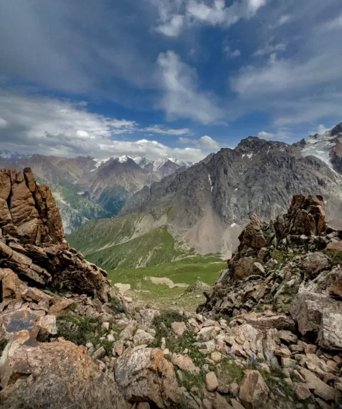
Chimbulachka is the highest and final summit of the route. It offers views of Shymbulak, Big Talgar Pass, neighbouring peaks and the upper section of Maloye Almatinskoye Gorge.
Do not remain on the summit during strong winds, thunderstorms or poor visibility. The descent to the pass also crosses rocky terrain and requires concentration.
Descent to Big Talgar Pass
From Chimbulachka, the route descends to Big Talgar Pass. The upper station of the Shymbulak Mountain Resort cable car is located at the pass.
The hiking section of MAK ends here. Participants then take the cable car to the Shymbulak base station before returning to Medeu.
Check the cable car operating hours on the day of the hike. They may change because of the season, maintenance, weather or resort schedule.
Missing the final cable car creates a serious problem. A walking descent from the pass significantly extends the route and may end after dark.
Set turnaround times before starting MAK. If the group is already behind schedule at Furmanovka or Panorama, continuing the full route is risky.
Distance from Medeu via Kimasar
The walking section of the classic route from the final Medeu bus stop through Kimasar Gorge, four summits and Big Talgar Pass varies from approximately 15.2 to 21 km across different GPS tracks. Participants then descend towards Shymbulak and Medeu by cable car and transport.
The variation is caused by several factors:
different starting points near Medeu;
detours to the swings and viewpoints;
the selected line of ascent to Chimbulachka;
ending the GPS recording at the pass or lower near Shymbulak;
short diversions around scree sections.
For safer planning, use the upper estimate of approximately 20-21 km on foot and up to 2,000 metres of elevation gain.
This is a one-way route. A walking return to Medeu is not included in the stated distance.
Why 20 km feels much harder
In an urban setting, 20 km may sound moderate. On MAK, the difficulty is determined by the elevation gain and terrain rather than distance alone.
During the day, participants climb from approximately 1,670 to 3,460 metres. Including the intermediate descents, total elevation gain reaches 1,900-2,000 metres.
After Furmanovka, most of the route remains above 3,000 metres. Pace may decrease at this elevation, fatigue can accumulate faster, and wind and cold have a stronger effect on the group.
Additional demands include:
the steep ascent from Enthusiasts’ Glade;
the rocky trail to Furmanovka;
several consecutive summits;
the descent from Bashuta;
the scree ascent to Chimbulachka;
the need to reach the cable car before it closes.
Who is the Malaya Almatinka Circuit suitable for?
The route is designed for experienced hikers with good endurance. Before attempting MAK, participants should ideally complete several day hikes covering 15-20 km with 1,500-2,000 metres or more of elevation gain.
Participants should be able to:
maintain a steady pace for 6-8 hours;
move across scree and rocky slopes;
manage their energy and food intake;
respond correctly to worsening weather;
make an independent decision to turn back.
The route is not suitable for young children, slow walkers, unprepared beginners or people ascending above 3,000 metres for the first time.
The reverse version from Big Talgar Pass via Chimbulachka to Medeu has less total elevation gain but includes a long descent. It places greater strain on the knees and does not make MAK an easy walking route.
Weather and suitable season
The snow-free months, when the ridge and scree sections are exposed, offer the clearest conditions for the classic route. Exact dates depend on the year’s snowfall.
Even in summer, the temperature on Chimbulachka may be significantly lower than at Medeu. The open ridge offers no natural protection from wind, rain or thunderstorms.
Main weather risks include:
afternoon thunderstorms;
strong winds;
sudden temperature drops;
fog and loss of visibility;
wet clay after rain;
snow and ice at higher elevations;
avalanche risk in winter and spring.
Start the hike early in the morning. Starting after 7:00 AM significantly reduces the time available before the cable car closes.
A winter attempt requires a separate plan, experience moving over snow and an avalanche conditions check. A summer GPS track must not automatically be treated as a safe winter route.
Water and food
The river and springs can be found in the lower part of Kimasar. After reaching the high ridge, reliable water sources are almost nonexistent.
Collect the main water supply before Enthusiasts’ Glade. The full route usually requires at least 2-3 litres per person, depending on the weather and individual needs.
Divide food into several smaller portions:
a quick snack near the swings;
a more substantial meal at Panorama;
an energy snack before Chimbulachka;
an emergency reserve in case of delays.
A heavy lunch may slow the group down. Food that can be eaten without preparation is more convenient.
What to bring
Equipment for the Malaya Almatinka Circuit should include:
hiking boots or shoes with a well-defined tread;
trekking poles;
a windproof jacket and waterproof outer layer;
a warm mid-layer;
a hat;
lightweight gloves;
sunglasses;
sun protection;
2-3 litres of water;
food and an emergency snack;
a personal first-aid kit;
a fully charged phone;
a power bank;
a headlamp;
an offline map and GPS track;
identification;
cash or a bank card for the cable car and transport;
a bag for personal rubbish.
A headlamp is required even with an early start. It provides a safety margin in case of delays, a route change or a technical suspension of the cable car.
Navigation and safety
The lower route to Furmanovka is popular and usually easy to follow. The trail between Panorama, Bashuta and Chimbulachka is less obvious, especially in fog.
Key rules for completing MAK:
Start early in the morning.
Check the cable car operation in advance.
Set turnaround times for Furmanovka and Panorama.
Do not enter the open ridge during a thunderstorm.
Do not continue in poor visibility.
Do not use all your water in Kimasar.
Do not take shortcuts across unfamiliar scree slopes.
Do not separate from the group.
Share the route and expected return time with someone.
Turn back if the pace is significantly slower than planned.
Furmanovka is the last convenient point for a straightforward return through Kimasar. After Panorama, any decision to continue must consider the weather, the group’s condition and the remaining time.
Notable route features
MAK covers almost every main type of terrain found in the mountains closest to Almaty within a single day. Participants begin among spruce forest, cross subalpine meadows, reach an exposed ridge and finish among rocks and scree at an elevation of approximately 3,460 metres.
The Kimasar Swings preserve the tradition of a hiking landmark that has existed here for several decades. Enthusiasts’ Glade marks the boundary of the forest zone and the beginning of the main high-altitude section.
Panorama Peak takes its name from its wide views. In clear weather, it overlooks the city, neighbouring gorges and the high peaks of the Trans-Ili Alatau.
Bashuta appears less distinct as a summit but plays an important role in the route’s terrain. After crossing it, participants lose elevation before the final ascent to Chimbulachka.
Chimbulachka completes the walking arc of MAK above Shymbulak resort. It is one of the few popular one-day routes in Almaty that connects the classic trail through Kimasar with the upper station of the mountain resort.
Summary
The Malaya Almatinka Circuit is a challenging route for well-prepared hikers. It begins near the final Medeu bus stop and passes through Kimasar Gorge, the Kimasar Swings and Enthusiasts’ Glade.
The main section includes four summits: Furmanov, Panorama, Bashuta and Chimbulachka. Depending on the GPS track, the walking distance is approximately 15.2-21 km, with 1,900-2,000 metres of elevation gain and a duration of at least 7-8 hours.
After Chimbulachka, participants descend to Big Talgar Pass and return via Shymbulak by cable car. Successful completion depends on an early start, stable weather, an appropriate pace and a willingness to turn back if the group falls behind schedule.
В этом походе уже стало понятно, что у многих появился новый вид зависимости)
Зависимость от алматинских гор и людей, с которыми туда ходишь.
МАК - на таких маршрутах особенно понимаешь ценность хорошего гида и хорошей группы. Никто никого не бросает, никто не торопит, все поддерживают друг друга, и к любой трудности относятся с юмором.
Показательный поход - физически тяжело, зато эмоционально - невероятно круто!
А когда всё закончилось, первая мысль:
что следующее?)
Благодаря Айдыну в целом поднялась впервые на 3000. До этого всегда думала, что не смогу или не осилю. МАК было сложно, но если прислушиваться у себе и своим ощущениям и идти в среднем темпе, то всё возможно благодаря адекватному терпеливому и весёлому Гиду и ребятам в группе, которые поддерживают на пути. Дорогу очень живописная и ее обязательно должен пройти каждый Алматинец!
АйданаБыло сложно, но мы это сделали Айдын, благодарю за возможность видеть эту красоту! Юмор, компания и погода сделали поход крутым!
Зарина


