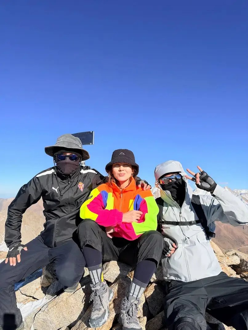
📸 How it went


What is included
❗️Cash payment only.
Route program
Group Meeting and Transfer to Alma-Arasan
Meeting and checking our equipment, headlamps, water supplies, and documents. At 02:10, we depart for the Prokhodnoye Gorge. We expect to begin the hike at around 02:50.
Al-Farabi - Dulati bus stop → Alma-Arasan parking area.Ascent to Terra Meadow
Following the trail through the Prokhodnoye Gorge using headlamps. We pass the thermal springs and waterfall area without lengthy stops. We climb through the forest to Terra Meadow, take a short break, and assess the group’s pace.
Alma-Arasan parking area → springs → Maiden’s Tears Waterfall → Terra Meadow.Ascent to the Pass and Karnizny Peak
Сontinue along the selected track through open meadows and rocky sections. We reach the pass and climb to the summit if conditions and the participants’ well-being allow.
Terra Meadow → Alyoshkin Bridge area → upper Prokhodnoye Gorge → Almaty-Alagir Pass → Karnizny Peak, 4,075 m.Descent via Terra Meadow to the Parking Area
Returning along the ascent route. We carefully navigate rocky sections, stream crossings, and trails near steep drops without taking shortcuts. Along the way, we make short stops for water and food.
Karnizny Peak → Almaty-Alagir Pass → Terra Meadow → Alma-Arasan parking area.Return Transfer and End of the Hike
Checking that all participants have returned and head back to the city.
Alma-Arasan parking area → Al-Farabi - Dulati bus stop.Description
Karnizny Peak near Almaty via Terra Meadow is a route that requires enough stamina to continue well beyond the familiar forest trail. You first pass the springs and waterfall, then climb to Terra and continue into the high mountains. This guide covers the distance from the Alma-Arasan parking area, the sequence of route sections, and preparation for a summit above 4,000 m.
A hike to Terra and an ascent of Karnizny Peak differ significantly in physical demands. The meadow is an intermediate stop, not the beginning of a short summit climb. Beyond it lie a long approach, a mountain pass, and the final ascent.
This guide describes the option through the Prokhodnoye Gorge and Almaty-Alagir Pass. The return follows the ascent route without continuing to Big Almaty Lake or the Cosmostation.
Where is Karnizny Peak, and what names appear on maps?
Karnizny Peak is located in the Trans-Ili Alatau near Almaty-Alagir Pass. Its elevation is usually listed as 4,075 m above sea level.
Descriptions use the names Karnizny Peak, Karniznaya Mountain, and Bauyrzhan Momyshuly Peak. When searching for a map or GPS track, check the summit’s location as well as its name.
The historical name refers to a snow cornice on the northeastern side of the mountain. A cornice is an overhanging projection of snow. Its edge may extend over empty space rather than solid ground. Approaching these formations for a photograph is dangerous.
The name Karnizny does not mean that every route necessarily crosses a cornice. The ascent line is chosen according to the terrain and current conditions, not the summit’s name.
How far is the summit from the Alma-Arasan parking area?
For planning, allow approximately 34-38 km round trip. This corresponds to around 17-19 km one way when returning along the same route.
This range accounts for differences between published routes. A GPS recording of a two-day hike shows 33.92 km. Another recording through the Prokhodnoye Gorge shows 34.09 km. A three-day itinerary with a camp near Alyoshkin Bridge lists 38 km.
These figures should not be treated as identical measurements of a single route. The authors may have started at different locations, chosen different approaches, or recorded additional movements. For your trip, check the distance against a track starting from your actual parking point.
| Parameter | Planning estimate |
|---|---|
| Start and finish | Parking area at the Alma-Arasan trailhead |
| Approach gorge | Prokhodnoye |
| Intermediate point | Terra Meadow |
| Main upper landmark | Almaty-Alagir Pass |
| Summit elevation | Approximately 4,075 m |
| Distance to the summit | Approximately 17-19 km |
| Total distance | Approximately 34-38 km |
| Total elevation gain | Approximately 2,200-2,400 m |
| Return route | Along the ascent route |
| Suggested planning format | 1-2 days for a prepared group |
The distance does not include the journey from a city bus stop to the parking area. If you walk part of the access road, add that distance separately.
Where does the walking route begin?
The route starts in the Prokhodnoye Gorge at the parking area near the turn toward the former Alma-Arasan resort. This is neither the parking area at the Ayusai visitor centre nor the second eco-checkpoint on the road to Big Almaty Lake.
When arranging a transfer, save the exact drop-off location. The name Alma-Arasan is sometimes used for a large area, so it may not lead the driver to the correct place.
Before travelling, confirm road access, national park entry requirements, and restrictions along your chosen route. Documents may be checked in the upper valley. Bring your identity card or passport and clarify the requirements for visiting the border area in advance.
Do not assume that rules from an old hiking report still apply. A track in an app does not confirm that every section is open and accessible.
What is the route through Terra Meadow?
The main sequence is: Alma-Arasan parking area, lower Prokhodnoye Gorge, Terra Meadow, Alyoshkin Bridge area, upper valley, approach to Almaty-Alagir Pass, and Karnizny Peak.
Springs and Maiden’s Tears Waterfall
The lower route passes the Alma-Arasan thermal springs and Maiden’s Tears Waterfall. Short stops are possible here, but an extended visit to the bathing pools must be accounted for separately.
The trail then gains elevation through the forest. Climbs alternate with traverses across the slope. Sections near water and bridges require care, particularly after rain.
The thermal springs should be described as a natural attraction and a place to relax. Do not promise therapeutic benefits or present bathing as preparation for a high-altitude ascent.
Forest trail and the Bolshoy Iguzek area
The approach to Terra passes birch groves, coniferous forest, and crossings of side gullies. One important section is associated with the Bolshoy Iguzek ravine.
Route descriptions mention eroded edges and old trail branches near steep drops. Here, it is particularly important to compare the route with recent information and assess the terrain on site. Do not follow an old path merely because it appears well worn.
Heavy precipitation can change the condition of these sections. If a crossing is damaged or looks questionable, do not attempt to bypass it on a steep slope without suitable experience.
Terra Meadow and the onward route
Terra lies at approximately 2,600-2,650 m. It is an open meadow with a spring known as Witch’s Stream. The area is used for rest stops and tent camps.
The distance from the parking area to the meadow is approximately 6 km. However, reaching Terra does not mean that most of the ascent is behind you. Many kilometres and substantial elevation gain still remain before the summit.
Check the onward direction at trail junctions. Around Terra and Alyoshkin Bridge, routes branch toward the upper Prokhodnoye Gorge, the Cosmostation, and other destinations.
Upper valley and Almaty-Alagir Pass
Higher up, the forest gradually gives way to open meadows and rocky terrain. The approach continues along the valley before turning toward Almaty-Alagir Pass.
Wind, sun, and visibility have a greater influence here. Even a moderate gradient can consume substantial energy over a long distance, particularly when carrying camping equipment.
Some itineraries in this area also visit Scotland Lake. It can be a separate stop if included in your chosen track. Do not automatically include it in the distance calculation for the summit route.
Ascent from the pass to Karnizny Peak
Beyond the pass, the final ascent follows the selected line. The upper sections include rocks and scree, while snow and ice may remain depending on the season and conditions.
Before entering the slope, the group must understand where the safe line runs, how the descent will be managed, and which conditions require turning back.
A broad summit or a relatively gentle section does not prove that the entire route is easy. Difficulty depends on the hardest section, the condition of the group, and the weather.
Does the route include Karniznoye Lake and a glacier?
Karniznoye Lake is not a required stop on the described approach via Almaty-Alagir Pass. It is a separate destination in a side branch of the Prokhodnoye Gorge.
The lake lies at approximately 3,500 m in the cirque of Tourist, Turan, and Karnizny peaks. Routes to it may begin at Terra or approach from the Cosmostation side.
A hike to the lake should not automatically be extended to the summit without separate preparation. An ascent across a glacier or another slope changes the character of the climb and the equipment requirements.
Karniznoye Lake and Scotland Lake should not be treated as the same location either. Check their positions on a map rather than relying only on photo captions.
How difficult is the hike, and how many days should you allow?
This is a demanding high-altitude route for prepared participants. The main challenge combines a long distance, more than 2,000 m of elevation gain, and travel above 4,000 m.
Descriptions give different technical difficulty ratings. These may refer to different slopes and conditions. A “non-graded” or “1A” classification therefore cannot be applied to every approach through Terra.
| Format | Features | Limitations |
|---|---|---|
| One day | The entire approach, summit ascent, and return without an overnight stay | Requires high endurance, route knowledge, and stable conditions |
| Two days | Approach to camp, followed by the ascent and return | The second day may be very long |
| Three days | Separate days for the approach, summit ascent, and descent | More reserve time, but a heavier backpack and more complex camp logistics |
For a group without experience of similarly long trips, a three-day format is generally easier to organise. However, an additional night does not itself guarantee acclimatisation or reaching the summit.
Do not use moving time from a GPS app as a complete schedule. It may exclude breaks, pauses in recording, and overnight stops.
When should you go, and how should you account for the weather?
For a hiking ascent, choose a period and route conditions in which the technical sections match the group’s skills. A summer date does not rule out snow, ice, or overnight frost.
Check the high-mountain forecast, not only the forecast for Almaty. Precipitation, wind, temperature, and thunderstorm probability all matter. Postpone the trip if hazardous weather is forecast.
An early summit start helps make use of daylight. However, do not promise that the weather is always safe before noon. Assess conditions throughout the day.
Set a turnaround time before leaving camp. Return earlier if visibility deteriorates, winds increase, progress is delayed, or someone feels unwell.
How should you prepare for an elevation of 4,075 metres?
Altitude-related symptoms can appear from approximately 2,500 m. Karnizny Peak takes you considerably higher, so experience with short walks near the city does not replace adaptation to altitude.
Risk depends on ascent speed and individual susceptibility. Good physical fitness does not eliminate altitude problems. Previous trips to altitude may help with preparation but do not guarantee that symptoms will not occur.
A headache accompanied by nausea, dizziness, or unusual weakness is a reason to stop ascending. If symptoms worsen, begin a safe descent with another group member.
Confusion, loss of coordination, or shortness of breath at rest require urgent assistance. Do not leave the participant alone. Drinking water and eating a snack do not replace descent when the condition is dangerous.
If you have a chronic medical condition or have previously experienced significant altitude symptoms, discuss the trip with a doctor.
What should you bring, and how should you organise an overnight stay?
Prepare footwear for uneven mountain terrain, warm layers, protection from wind and precipitation, gloves, and a hat. You also need sunglasses, a headlamp, an offline map, communication equipment, and a personal first-aid kit.
Do not promise participants that crampons, an ice axe, or a rope will definitely be unnecessary. Technical equipment requirements depend on the specific upper section. Participants must know how to use that equipment.
For an overnight stay, bring a tent, sleeping bag, and sleeping mat suitable for the expected temperatures. Choose a campsite away from streambeds, potential rockfall zones, and hazardous slopes. A hut shown on a map does not guarantee unrestricted access or accommodation.
Plan water supplies for each section, particularly between the last reliable source and the summit. Treat water from streams and springs as needed. Divide food between the approach, ascent, and return, keeping a reserve for delays.
Conclusion
Karnizny Peak near Almaty via Terra Meadow is an approximately 34-38 km route reaching above 4,000 m. Plan it according to a specific track, the condition of the upper section, and the group’s abilities, while keeping enough time and energy for the return.
Sources
Guidance on altitude-related symptoms, CDC Yellow Book - cdc.gov/yellow-book, High-Altitude Travel and Altitude Illness section.
Очень классный поход с невероятно живописными видами и безумно красивым лесом!
Подъём действительно тяжёлый и местами кажется бесконечным. В какой-то момент начинаешь думать, что гора вообще никогда не закончится и до вершины ты так и не дойдёшь (это самообман-не ведитесь, просто идите!)😂
Но когда всё-таки добираешься наверх, понимаешь, что оно того стоило на все 100 %! Невероятные виды на 360° - просто обалдеть! 🏔️


