
📸 How it went


What is included
Route program
Group meeting point
Meet at the designated bus stop, get to know the group, check our gear, and review the safety rules.
GES-2 bus stopTransfer and start of the hike
We travel from the bus stop to the start of the hiking route in Prokhodnoye Gorge. After arriving, we begin the ascent to Terra Glade.
Start of the routeThermal spring and waterfall
Following the mountain river past the Alma-Arasan thermal spring and Maiden’s Tears Waterfall. Short breaks are planned along the way for rest and photos.
Initial ascentRest at Terra Glade
Arriving at Terra Glade, take a break, have lunch, and photograph the mountain views. The final point is approximately 2,630-2,650 metres above sea level.
Terra Glade and its attractionsDescent and return transfer
Descend along the same route to the starting point. After completing the hike, we take the transfer back to the bus stop.
Start point of the routeDescription
Terra Glade (Polyana Terra) is a scenic mountain destination in Prokhodnoye Gorge in the Trans-Ili Alatau. Located close to Almaty, the route is suitable for a full-day hike. Along the way, hikers follow the Prokhodnaya River, cross several bridges and visit the Alma-Arasan thermal springs and Maiden’s Tears Waterfall.
This is not a short walk near the city. The trail to the glade includes a long ascent, forest sections, trail junctions and areas with steep slopes. In dry, warm-season conditions, the main route does not usually require mountaineering equipment or rock-climbing skills.
Route W01 at a glance
Name: Terra Glade
Area: Almaty mountains, Trans-Ili Alatau
Gorge: Prokhodnoye Gorge
Starting point: Alma-Arasan area
Route type: out and back
One-way distance: approximately 6-7 km
Total distance: approximately 12-14 km
Elevation of Terra Glade: approximately 2,630-2,650 m
Elevation gain: approximately 900-950 m
Hiking time: 6-8 hours, including stops
Difficulty: technically moderate, with above-average physical demands
Key landmarks: Alma-Arasan thermal springs, Maiden’s Tears Waterfall, Prokhodnaya River, Witch’s Creek and Terra Glade
Where is Terra Glade?
Terra Glade is located in Prokhodnoye Gorge in the mountainous part of Almaty. The gorge is often called Alma-Arasan after the former resort and the thermal springs in its lower section. Its correct geographical name is Prokhodnoye Gorge.
The glade sits approximately 2,630-2,650 metres above sea level. It is surrounded by coniferous forest, mountain slopes and open areas overlooking the peaks of the Trans-Ili Alatau.
Witch’s Creek is located near the glade. It is formed by several cold springs emerging from the ground. Thanks to its flat camping areas and nearby water source, Terra Glade has long been used by hikers as a rest and camping point on longer mountain routes.
Starting the hike to Terra Glade
The hiking section begins near Alma-Arasan in the lower part of Prokhodnoye Gorge. The first sections follow the Prokhodnaya River. The trail crosses the river several times using bridges and wooden walkways.
The lower part of the route is relatively easy. There is no sharp elevation gain, so hikers can settle into a comfortable pace before the longer ascent.
The condition of the bridges and trail may change after rain, spring snowmelt or sudden weather changes. Check current route information before setting out.
Alma-Arasan thermal springs
One of the first notable landmarks on the route is the Alma-Arasan thermal springs. Located next to the river, they are a popular mountain recreation spot among Almaty residents.
The name “Alma-Arasan” is associated with the warm springs that reach the surface in this part of the gorge. The route to Terra Glade passes near the developed spring area.
A long stop here is not recommended on the way up, especially if the hike was started late. Most of the distance and elevation gain still lies ahead.
Maiden’s Tears Waterfall
The next landmark is Maiden’s Tears Waterfall. It is located close to the main trail and does not require a long detour.
The waterfall is small but blends well with the forest landscape of Prokhodnoye Gorge. Its flow is strongest during snowmelt and after rainfall. During dry periods, the flow may become weaker.
The waterfall is a convenient place for a short break. Rocks near the water are often wet and slippery, so take care when approaching the edge.
Ascent through the forest
After the waterfall, the more demanding part of the route begins. The trail gradually climbs through coniferous forest, birch groves, streams and small open clearings.
Some sections of the ascent are steep. The route includes junctions, old trails and eroded areas. Do not choose a shortcut simply because it appears more direct. Some side trails may lead towards steep drops or away from the main route.
Download an offline map or GPS track in advance. Mobile coverage in the gorge may be unreliable.
What is at Terra Glade?
After a long climb through the forest, the trail reaches an open glade. Terra Glade is located next to Witch’s Creek at an elevation of approximately 2,630-2,650 metres.
The glade offers views of Prokhodnoye Gorge, forested slopes and the surrounding mountain peaks. It is a convenient place for a longer rest before the descent.
The glade also serves as an intermediate point for longer and more challenging routes. Trails from here lead towards Alyoshkin Bridge, the upper part of Prokhodnoye Gorge and other high-altitude destinations.
If Terra Glade is the final destination, return along the same trail after resting. Continuing farther will increase the distance, elevation gain and total time spent in the mountains.
Distance to Terra Glade
Depending on the selected trail, the distance from the start of the hiking route near Alma-Arasan to Terra Glade is approximately 6-7 km one way.
Key route figures:
To the glade: approximately 6-7 km
Round trip: approximately 12-14 km
Elevation gain: approximately 900-950 m
Maximum elevation: approximately 2,630-2,650 m
Hiking time: 6-8 hours, including stops
The actual distance may vary slightly depending on the starting point, selected trail and additional stops at the springs, waterfall or other locations.
Route difficulty
The route to Terra Glade is technically moderate but requires good physical fitness. The main challenge is the long ascent and an elevation gain of approximately 900-950 metres.
The hike is suitable for:
active beginners with a reasonable level of fitness;
hikers with previous day-hike experience;
people prepared to spend 6-8 hours in the mountains;
participants with suitable footwear and clothing.
The route may be difficult for people with no experience of long-distance walking, young children and anyone who struggles with prolonged ascents.
Best time to hike to Terra Glade
Summer and early autumn usually offer the most suitable conditions, especially in dry weather. During this period, the trail is easier to follow and there is less snow on the upper sections.
In spring, the route may be wet due to melting snow. Water levels in the river and streams rise, while the ground becomes slippery.
The difficulty increases significantly in winter and early spring. Snow and ice cover the trail, short daylight hours limit available time, and avalanche conditions must be considered on some slopes. A winter hike requires appropriate experience and equipment.
Even in summer, the weather above 2,600 metres can change quickly. Check the forecast for rain, temperature and wind before setting out.
What to bring
Recommended equipment for the hike includes:
hiking shoes or boots with non-slip soles;
comfortable clothing for a long hike;
a warm layer in case the temperature drops;
a raincoat or waterproof jacket;
at least 1.5-2 litres of water per person;
snacks or a full packed lunch;
trekking poles;
a hat and sun protection;
a small flashlight or headlamp;
a fully charged phone and power bank;
an offline map or saved GPS track;
a personal first-aid kit.
Carry more water in hot weather. Do not rely only on streams and springs unless you have a suitable water treatment system.
Safety on the route
Start the hike in the morning so you can complete most of the ascent before the midday heat and return before dark.
Basic safety rules:
Do not start the route during heavy rain, thunderstorms or poor visibility.
Do not leave the main trail for poorly marked side paths.
Take care when crossing bridges, wet rocks and eroded slopes.
Keep away from the edges of steep drops.
Save an offline GPS track before starting the hike.
Tell someone your planned route and expected return time.
Check the current access rules for the area.
Take all rubbish with you.
The condition of the trail, bridges and spring area may change. Old route descriptions should not be treated as a guarantee of safety.
Frequently asked questions
How many kilometres is it to Terra Glade?
The glade is approximately 6-7 km from the start of the hiking route near Alma-Arasan. The total round-trip distance is approximately 12-14 km.
What is the elevation of Terra Glade?
Terra Glade is located approximately 2,630-2,650 metres above sea level.
What is the elevation gain?
The total elevation gain is approximately 900-950 metres.
How long does the hike take?
Allow 6-8 hours, including rest breaks and stops at the thermal springs and waterfall.
What can you see along the route?
The main landmarks are the Prokhodnaya River, Alma-Arasan thermal springs, Maiden’s Tears Waterfall, coniferous forest, mountain streams, Witch’s Creek and Terra Glade.
Is the route suitable for beginners?
Fit beginners can complete the route in dry weather. However, the 900-950-metre elevation gain requires endurance and suitable footwear.
Can you hike beyond Terra Glade?
From the glade, the route can be continued towards Alyoshkin Bridge and the upper part of Prokhodnoye Gorge. This adds distance and hiking time, so the extension should be planned separately.
Summary
Terra Glade is one of the most varied full-day hiking routes in the Almaty mountains. Within a relatively compact distance, hikers can see the Alma-Arasan thermal springs, Maiden’s Tears Waterfall, the Prokhodnaya River, coniferous forest and a high-altitude glade near Witch’s Creek.
The total round-trip distance is approximately 12-14 km, depending on the starting point. The destination sits at an elevation of approximately 2,630-2,650 metres, with an elevation gain of around 900-950 metres. Safe completion requires reasonable physical fitness, suitable footwear, an early start and a weather check before departure.
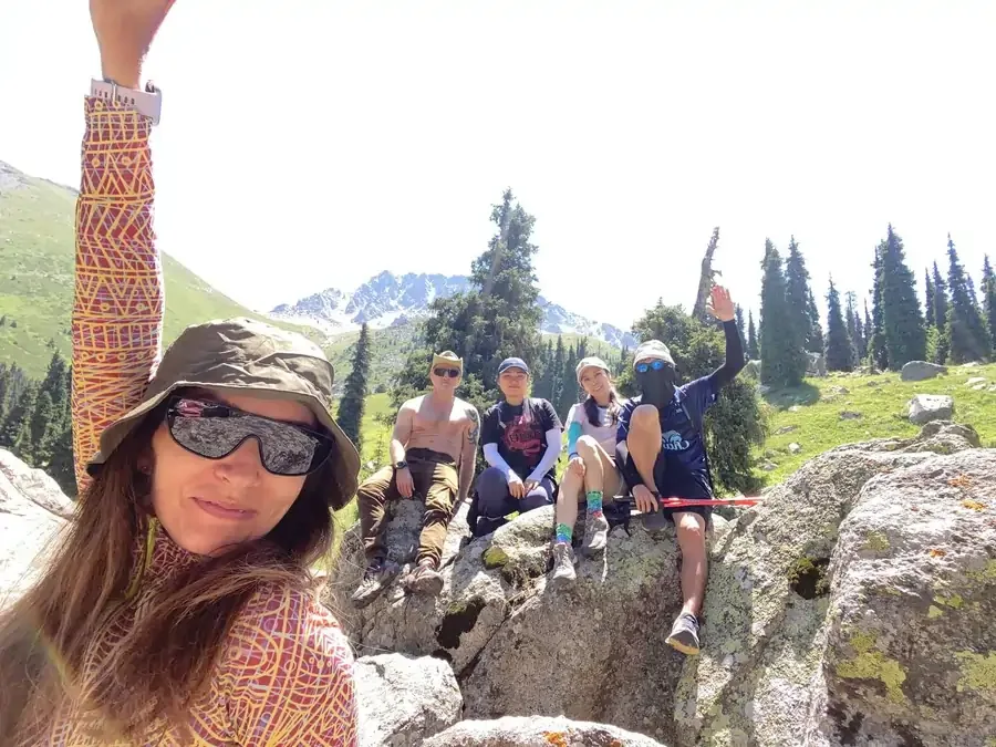
Терра - красивый маршрут, и даже, если вы там были ни раз, его однозначно стоит пройти в компании Айдына ) Алёшкин мост стал прекрасным бонусом, а купания в ведьмином ручье - отдельный вид горного удовольствия))
Жанна МусабаеваВ субботу сходили на поляну Терра и до Алёшкиного моста 🏔️
Расстояние составило 15 км, и заняло около 7 часов. Несмотря на жару в городе, в горах было очень комфортно.
Маршрут красивый, протяжённый и довольно требовательный, поэтому новичкам без подготовки может быть непросто. Но виды и атмосфера того стоят!
Особенно понравилась живописная поляна и кристально чистая, ледяная вода Ведьминого ручья. Самые смелые из нашей компании даже искупались 🥶
Получился очень весёлый и душевный поход в отличной компании. Айдын, спасибо, как всегда, всё было на высшем уровне! 🙌🏽
Это был идеальный поход. Организация, трансфер, кол-во людей, компания, темп, погода, сам маршрут, отсутствие пробок и затыков по приезду и выезду – благодаря грамотному планированию. Прям идеальный день, каких мало. Айдыну большое спасибо.
Дмитрий


