
📸 How it went

Route program
Group meeting
Meeting at the benches near the fountain, check our gear, and review the route and safety rules.
By the fountainAscent toward the Gorelnik Gorge
We begin the ascent through the Small Almaty Gorge.
Along the Student TrailAscent via the Tuyuk-Su mountaineering camp
Ascending to Shymbulak, then continue along the mountain road beside the Malaya Almatinka River. We pass through the Tuyuk-Su area and the active alpine camp. Short stops for rest and photos are planned.
Gorelnik - Shymbulak - Tuyuk-Su Alpine CampBlack Waterfall
Reaching Black Waterfall, surrounded by dark cliffs. We take a break, take photos, and prepare for the return journey. The waterfall’s flow depends on the season and recent precipitation.
Black Waterfall, approximately 2,650 mMemorial, descent, and transfer
On the way back, we visit the Memorial to Those Who Died in the Mountains. We then descend to Shymbulak and return to Medeu.
Memorial to Those Who Died in the Mountains - Shymbulak - MedeuDescription
The hike to the Black Waterfall is a mountain route starting from Medeu, then continuing from Shymbulak to the Tuyuk-Su area. It passes through the upper part of the Small Almaty Gorge, not far from Medeu and Almaty.
Along the way, you can see the active Tuyuk-Su alpine camp, the Malaya Almatinka River, the rocky walls of the Trans-Ili Alatau, and the Memorial to Those Who Died in the Mountains. The final point of the route is located at about 2650 meters above sea level.
The Black Waterfall is especially interesting during the active snowmelt period. Its flow is seasonal, so before the hike it is important to consider the time of year and the amount of precipitation.
Main Route Characteristics
-
Area: Almaty mountains, Trans-Ili Alatau
-
Gorge: Small Almaty Gorge
-
Area: Tuyuk-Su
-
Route start: Shymbulak mountain resort
-
Distance to the waterfall: about 9 km
-
Round-trip distance: about 18-19 km
-
Shymbulak altitude: approximately 2200 m
-
Black Waterfall altitude: about 2650 m
-
Waterfall height: approximately 30 m
-
Elevation gain: about 450 m
-
Duration: 5-6 hours with stops
-
Difficulty: moderate easy on the main road, moderate on the approach to the waterfall
-
Main points: Shymbulak, Tuyuk-Su alpine camp, Black Waterfall, and the Memorial to Those Who Died in the Mountains
The distance may vary slightly depending on the chosen trail and additional stops.
Where the Black Waterfall Is Located
The Black Waterfall is located in the Tuyuk-Su area, in the upper part of the Small Almaty Gorge. This is a mountain area near Medeu and Shymbulak, about 20 kilometers from central Almaty.
The waterfall is located slightly above the Tuyuk-Su alpine camp. It is formed by a stream flowing down from the Gorelnik spur and falling along a dark rock wall.
The waterfall got its name from the almost black shade of the wet rocks. The water cascade is about 30 meters high, and the location itself is situated at approximately 2650 meters above sea level.
Start of the Route at Shymbulak
The walking part of the route starts from Medeu, then continues to Shymbulak, which is located at an altitude of about 2200 meters. You can get here from Medeu by cable car or on foot.
From Shymbulak, the route goes up the Small Almaty Gorge. The main part of the path follows a wide mountain road along the Malaya Almatinka River.
This section offers views of rocky slopes and snow-covered peaks of the Trans-Ili Alatau. The route gradually gains elevation but does not include technically difficult obstacles.
After about 2 km, there is a turn toward the Tuyuk-Su alpine camp. The route then descends to the river and crosses to the other side by a bridge.
Tuyuk-Su Alpine Camp
The Tuyuk-Su alpine camp is located above Shymbulak, in the central part of the Small Almaty Gorge. It is an active sports base connected with the history of Kazakhstani mountaineering.
Beginner and experienced mountaineers train at the camp. Routes to Mynzhylky, the Tuyuk-Su Glacier, high-altitude stations, and surrounding peaks start from here.
During the hike, participants pass near the alpine camp area. It is necessary to follow the established rules, not enter service zones without permission, and not disturb training activities.
After the alpine camp, about one kilometer remains to the Black Waterfall.
Approach to the Black Waterfall
After the alpine camp, the route continues up the gorge. First, the trail passes through a relatively flat section, then approaches the streambed.
The final part of the route is more difficult than the main road. There are rocks, wet ground, and a small rocky ledge. After rain or during snowmelt, the surface can be slippery.
It is not recommended to approach directly under the falling water. Stones may fall from the rock wall, and wet areas near the waterfall have poor traction.
In winter and early spring, snow and ice may remain in the waterfall niche. In such conditions, the route becomes more difficult.
What the Black Waterfall Looks Like
The Black Waterfall is about 30 meters high. Water flows down a dark rock wall, creating a noticeable contrast with the lighter parts of the gorge.
The waterfall is not constant. The strongest flow can usually be seen in May and June, when snow actively melts in the mountains. After prolonged precipitation, the amount of water also increases.
In the second half of summer, the flow often becomes weak. During dry periods, the water may almost completely disappear, leaving only a wet black rock where the waterfall was.
That is why a full-flowing waterfall cannot be guaranteed on any given date. Before the hike, it is better to check the current condition of the route.
Memorial to Those Who Died in the Mountains
After visiting the waterfall, the route returns to the main Tuyuk-Su road. Along the way, you can visit the Memorial to Those Who Died in the Mountains.
The memorial was created in 1999 using funds collected by representatives of Kazakhstan’s mountaineering community. It is dedicated to mountaineers, hikers, and travelers who did not return from mountain hikes and ascents.
The memorial plaques list the names of those who died. Every year, commemorative events are held here with the participation of mountaineers, sports veterans, and relatives.
This is a place of remembrance, so near the memorial you should keep quiet and treat the area with respect.
Route Difficulty
The main part of the route follows a wide mountain road and does not require mountaineering experience. However, the steady elevation gain creates a physical load.
The most difficult part is the final approach to the waterfall. Here you have to walk over rocks and wet ground, and in some places overcome a small rocky ledge.
The route is suitable for:
-
active beginners;
-
hikers with basic physical fitness;
-
participants who can walk uphill for several hours;
-
families with teenagers in dry weather.
After rain, or when snow or ice is present, the hike becomes noticeably more difficult.
When Is the Best Time to Go to the Black Waterfall
The best chance to see the Black Waterfall with a strong flow is usually in May and June. During this period, the flow increases because of snowmelt.
In summer, the route remains accessible for a walk, but in July and August the waterfall may become low-flow or temporarily dry up.
In autumn, the amount of water depends on precipitation. In dry weather, only a small stream may remain on the rocks.
In winter, the waterfall partially freezes. Ice and snow appear on the road and on the final approach. Before a winter hike, it is necessary to check the weather, trail condition, and avalanche situation.
Safety on the Route
Before setting out, you need to check the weather forecast and the condition of the road above Shymbulak.
Main rules:
-
Do not start the route during a thunderstorm or heavy rain.
-
Do not approach directly under the waterfall.
-
Do not climb the wet rock wall.
-
Cross rocky and icy sections carefully.
-
Do not enter closed areas of the alpine camp.
-
Do not continue if the weather suddenly worsens.
-
Take all trash with you.
During snowy periods, avalanche danger must be assessed separately. Being close to Shymbulak does not make a high-mountain route completely safe.
Summary
The hike to the Black Waterfall allows you to see several important places in the Small Almaty Gorge in one day. The route goes from Shymbulak through the active Tuyuk-Su alpine camp to a seasonal waterfall located at about 2650 meters.
On the way back, you can visit the Memorial to Those Who Died in the Mountains. The total distance is about 19 km, and it is better to allow 5-6 hours for the route.
The main limitation of the route is the seasonality of the waterfall. The best time to see a strong flow is usually May and June.
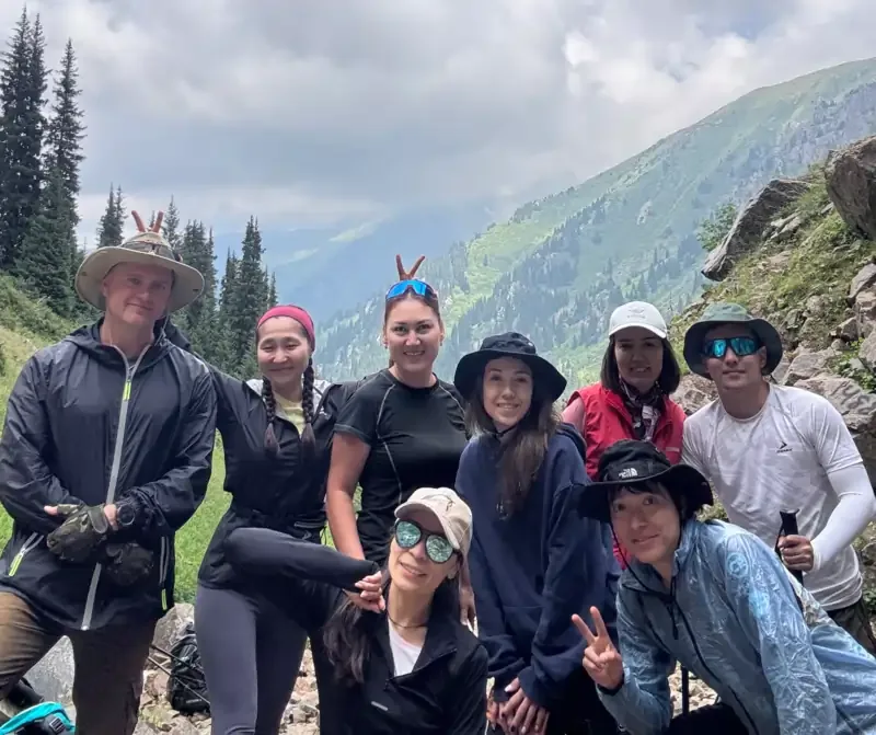
Всё прошло отлично. Несмотря на то, что на самом водопаде воды не было, это позволило подойти близко. Виды потрясающие. Поход и организация на высоте.
Дмитрий


